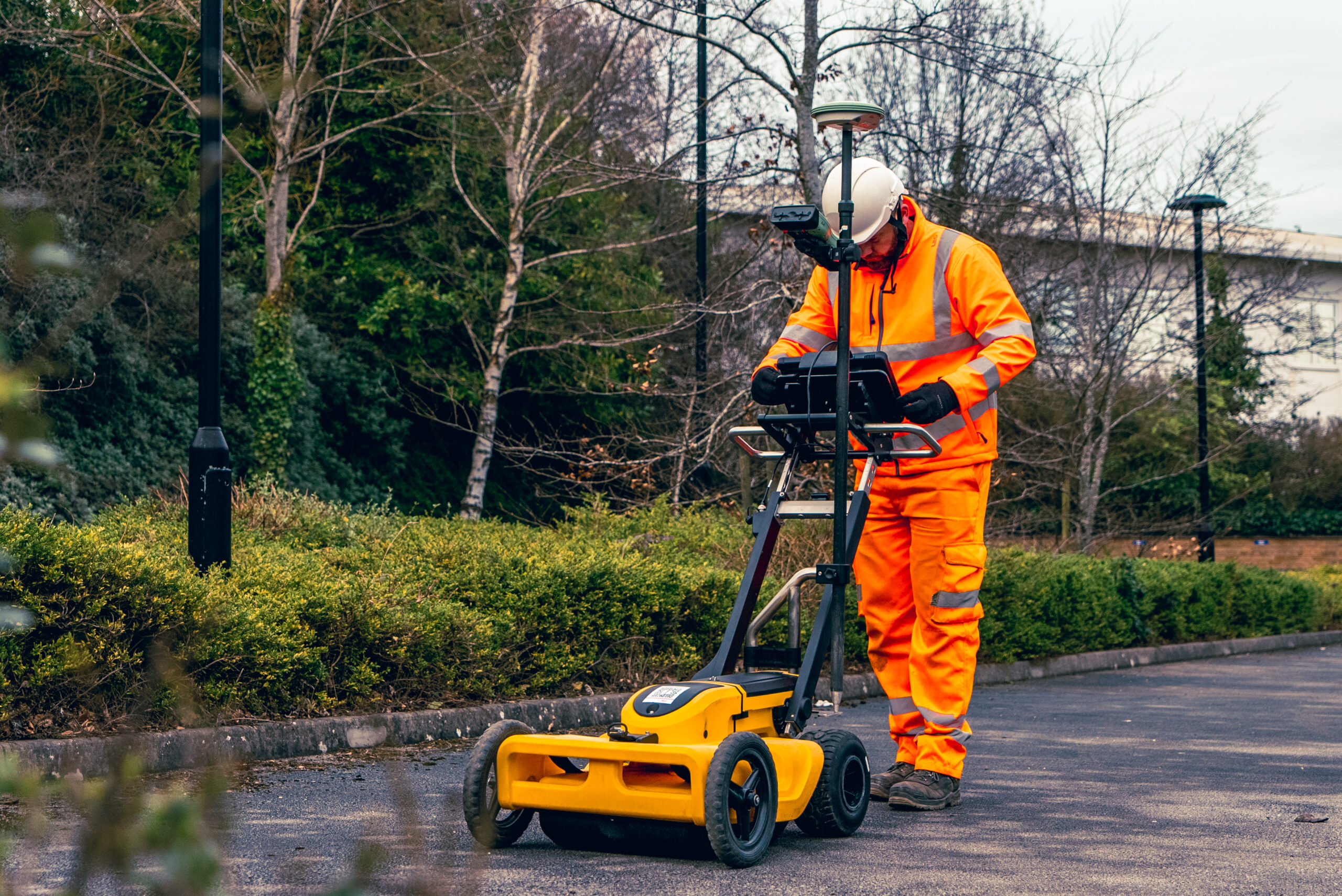
A GPR survey uses Ground Penetrating Radar to identify subsurface anomalies and features by transmitting radar pulses into the ground and interpreting the returned signal. GPR is commonly used to support utility detection, confirm unknowns where records are unreliable, and assess areas where other detection methods may be limited by site conditions.
When GPR is used without clear scope, appropriate survey design, or transparent reporting, outputs can be misinterpreted and risk increases. PROFIND Surveys delivers controlled GPR surveys with defined objectives, validated referencing where required, and quality-checked deliverables that support decisions.
Survey requirements are agreed prior to site attendance, including:
This prevents ambiguity and ensures the survey is designed around your risk and decision needs.
Where mapping and integration are required, survey control is established and referenced to an agreed coordinate system and vertical datum before data acquisition.
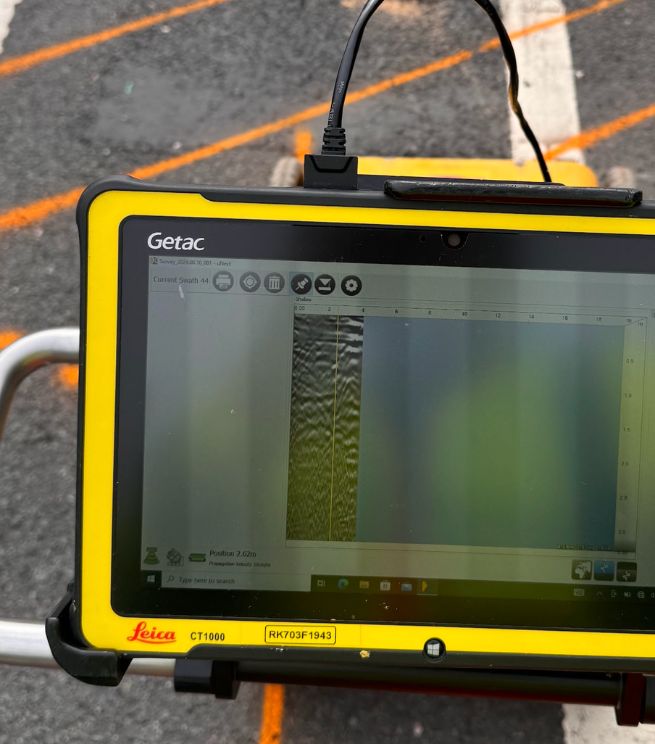
Data is collected using a defined survey pattern appropriate to the site and objectives. Line spacing and coverage are selected to support interpretation confidence. Findings are interpreted in line with the agreed scope, with clear distinction between detected responses, inferred features and limitations created by site conditions.
All datasets and outputs undergo internal QA prior to issue, including:

Outputs are structured for practical use and may include:
GPR survey report summarising methodology, coverage and findings
Annotated plans showing survey coverage and interpreted anomalies/features (as scoped)
CAD deliverables layered to agreed specification where required
Metadata confirming coordinate system, datum, extent and date of capture
Clear statements of limitations, confidence and any constraints affecting interpretation
All deliverables clearly state survey limits, access constraints and the intended use of the outputs.
A properly specified and quality-assured GPR survey:
Improves confidence where records are incomplete or unreliable
Supports safer planning by identifying unknown subsurface responses early
Reduces redesign and delays caused by late discovery of constraints
Strengthens utility detection when used alongside complementary methods
Helps focus intrusive investigations (trial holes) to the right locations
Provides clearer evidence for stakeholder discussions and risk decisions
To scan below the surface and help identify features and anomalies. It’s often used to support utilities mapping and reduce unknowns before intrusive works.
No. GPR can’t detect some services if they’re too small or too deep, and results depend on ground conditions.
When the environment isn’t optimal due to soil or ground conditions. We’ll advise during scoping.
Yes. GPR is often used alongside EML and records review, especially on complex sites.
Yes. We can convert GPR data into detailed 2D models and support integration with AutoCAD/BIM.
Profind Surveys is based in Tamworth and focuses on the Midlands.
Where required, topographical surveys can be coordinated with:

as a complementary detection method
to support targeted verification in dig areas

to reference outputs into a verified site framework

for structured CAD/BIM integration
A single verified control framework ensures consistency across disciplines where applicable.
Profind Surveys starts with a consultation so we understand your requirements and recommend the right approach for your programme and deliverables.


Scope defined before mobilisation, aligned to your objectives and risk profile.
Survey design and coverage planned to support interpretation confidence.
Quality-assured outputs with clear findings, limitations and structured deliverables.
Ongoing technical clarification where required.
If you require GPR survey outputs delivered under defined methodology and structured QA, contact Profind Surveys Ltd to discuss your site conditions, objectives and programme.