Survey measurements are only useful when they can be integrated directly into design and construction workflows. Poorly structured survey models can introduce errors such as surface inconsistencies, break line conflicts or missing feature connectivity, which may propagate into design models or machine control systems.
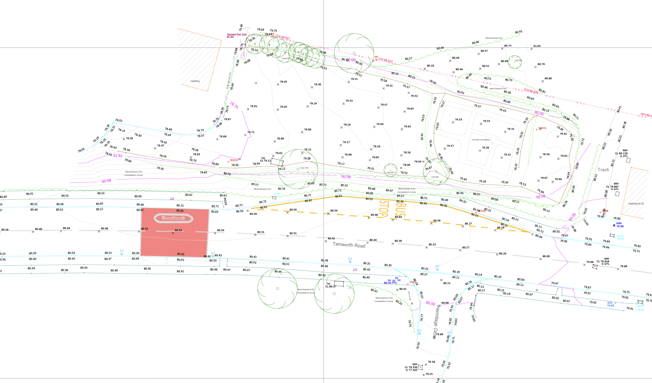
Digital survey outputs focus on converting measured survey data into structured engineering models that can be used reliably within CAD, BIM and construction systems.
All survey observations from GNSS, total stations, laser scanning and UAV platforms are processed within a verified coordinate framework prior to any modelling or data extraction.
The processed dataset is interpreted and structured into engineering models suitable for design and construction use.
During model development, geometric checks are performed to identify inconsistencies such as:
These checks ensure that the digital model accurately represents the measured site conditions.
Digital survey data may be developed into a range of structured outputs depending on project requirements. Typical deliverables include:
2D / 3D CAD models.
Digital terrain models (DTM).
BIM-compatible geometry.
Structured point cloud datasets.

Where required, survey data can also be developed into engineering models used directly in construction workflows, including:
3D machine control models.
Terrain models for design integration.
Volumetric analysis datasets.
These outputs allow measured survey information to be integrated directly into design, analysis and construction systems.
Profind Surveys starts with a consultation so we understand your requirements and recommend the right approach for your programme and deliverables.


Outputs issued to agreed CAD/BIM standards with clear metadata.
Verified datum and coordinate consistency across deliverables.
Quality-assured files ready for design and coordination workflows.
Clear issue packs with version control and technical clarification where required.
If you require structured deliverables built from verified survey data and issued under defined QA, contact Profind Surveys Ltd to discuss your requirements.
No. We can work from existing survey outputs and drawings. It’s just quicker and cleaner when Profind captures the data as well.
Yes. We can support conversions like PDF to DWG where needed.
Yes. We can convert GPR data into detailed 2D models and drawings.
We’ll confirm formats during scoping (DWG, PDF, and others depending on the project).
Profind Surveys is based in Tamworth and focuses on the Midlands.