A PAS128 utility survey locates and maps detectable underground services using appropriate detection methods, then presents the results in a controlled format referenced to an agreed coordinate system and vertical datum. Outputs support safer design, excavation planning, enabling works, and risk management by reducing uncertainty around buried utilities.
When records are relied on without verification, or surveys are undertaken without clear scope, quality level and deliverable standards, the risk of strikes, redesign, delay and dispute increases. Profind Surveys delivers verified, quality-checked PAS128 outputs that design and site teams can rely on throughout the project lifecycle.
Survey requirements are agreed prior to site attendance, including:
This prevents ambiguity and ensures the correct level of detection, validation and reporting from the outset.
Survey control is observed and processed so utility outputs can be referenced consistently to the agreed coordinate system and vertical datum.
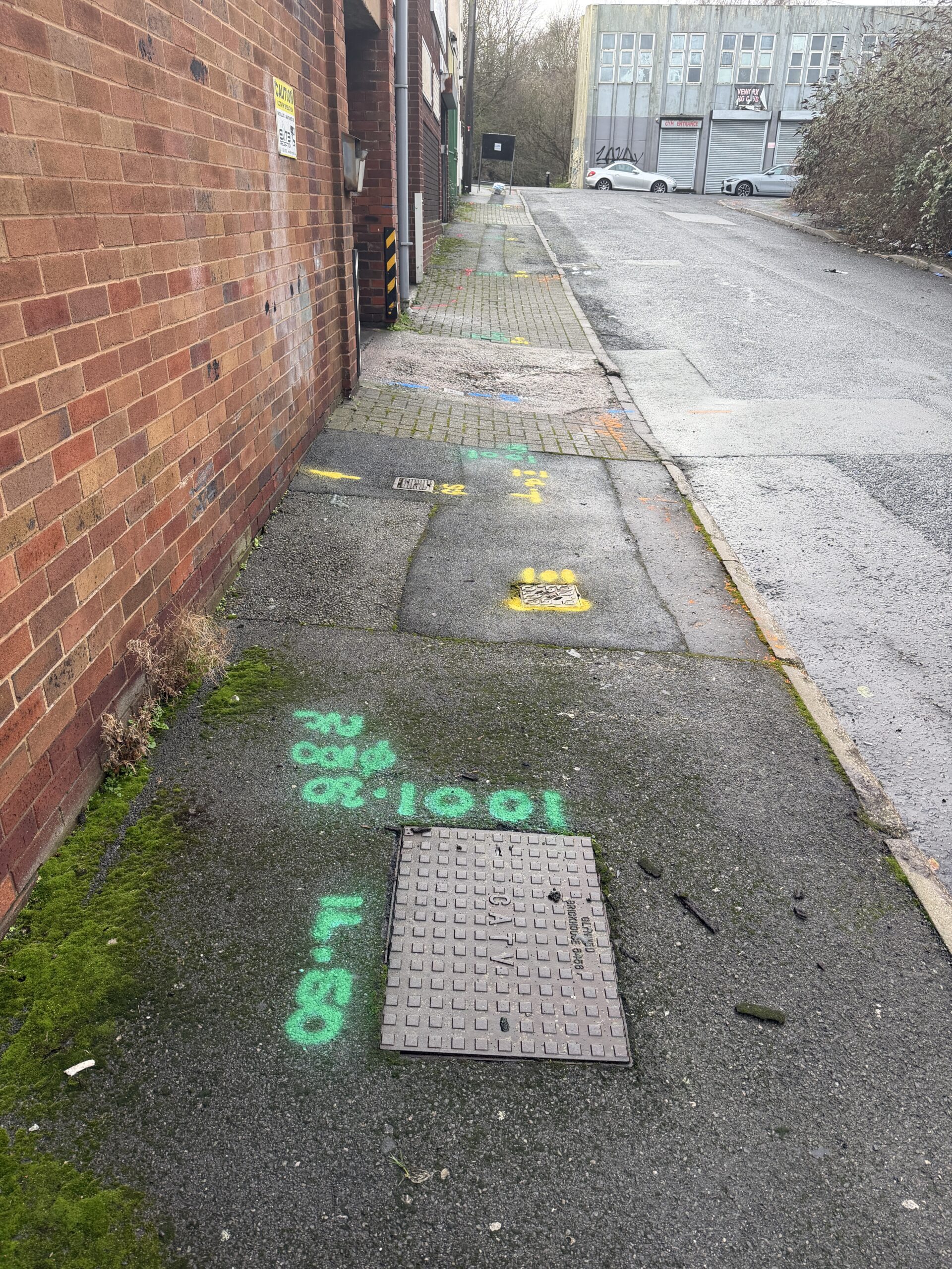
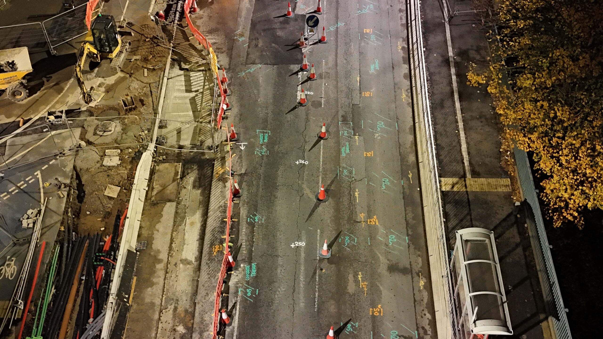
Detection methods are selected according to required outcomes, site conditions and risk profile. Where appropriate, this may include electromagnetic location (EML) and ground penetrating radar (GPR), with systematic site coverage to identify detectable utilities and generate reliable mapping.
Where available, record information is reviewed and used to guide the survey strategy, with findings presented transparently so limitations and confidence levels are understood.
All datasets undergo internal QA prior to issue, including:
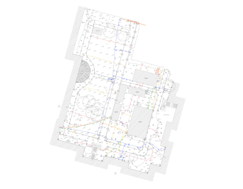
Outputs are structured for immediate integration into design and construction workflows and may include:
2D CAD utility drawings layered to agreed specification
Utility plans suitable for design coordination and excavation planning
Supporting report including methodology, scope, limitations and survey date
Metadata confirming coordinate system, datum and survey extent
Optional site markings and photo records where defined in scope
All deliverables clearly state survey limits, access constraints, control reference and the date of capture.
A properly specified and quality-assured PAS128 utility survey:
Reduces the risk of utility strikes and associated safety incidents
Minimises redesign caused by late discovery of services
Improves planning for excavation, enabling works and temporary works
Supports safer method statements and permit planning
Reduces programme disruption caused by unexpected constraints
Strengthens stakeholder assurance with traceable, referenced outputs
Where required, PAS128 utility surveys can be coordinated with:
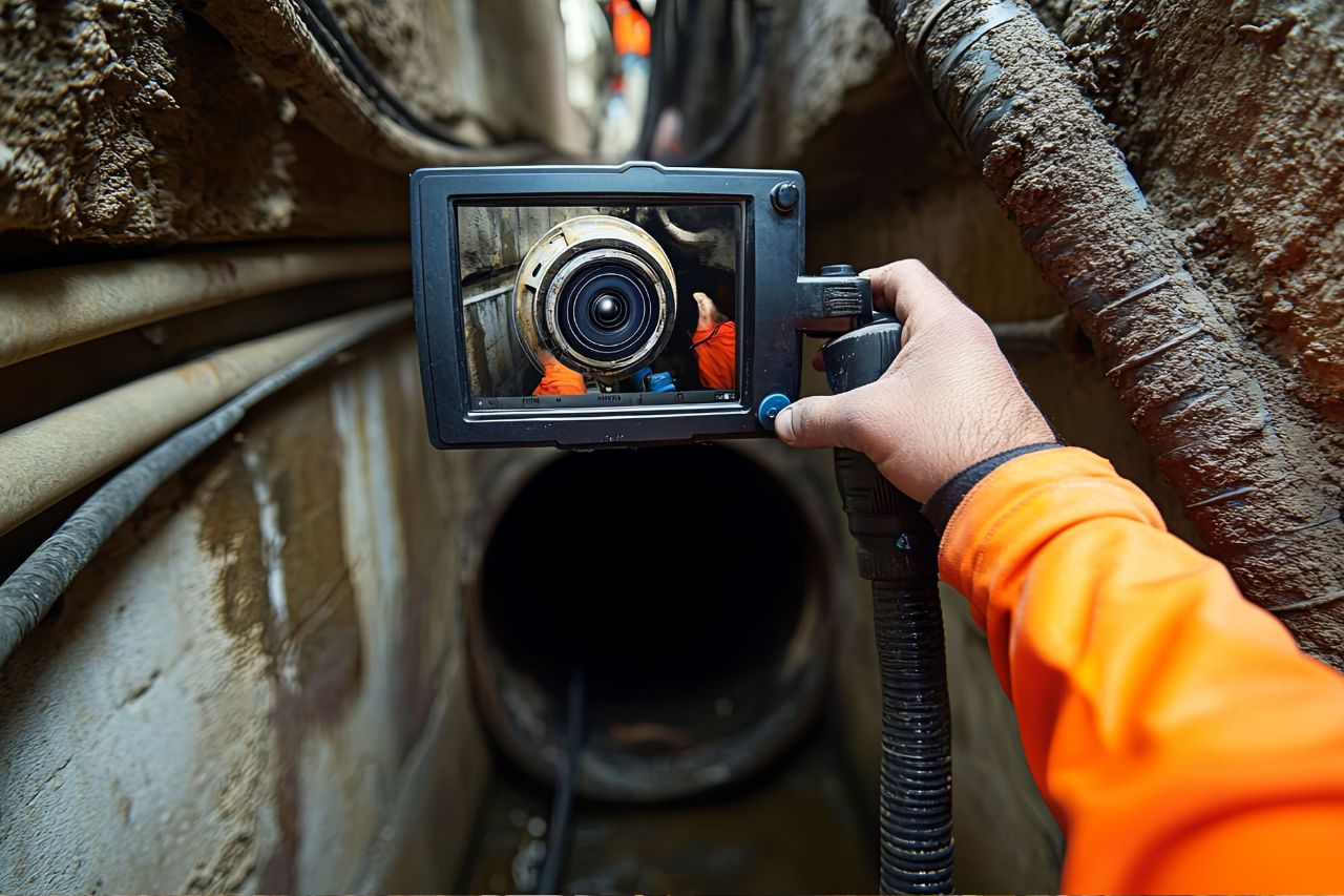
for excavation support and verification

to tie utilities into a single verified control framework
to support drainage understanding and interfaces

for structured CAD/BIM integration
A single verified control framework ensures consistency across disciplines where applicable.
Profind Surveys starts with a consultation so we understand your requirements and recommend the right approach for your programme and deliverables.


Scope defined before mobilisation, including deliverables, extent and constraints.
PAS128 compliant detection strategy aligned to site conditions and risk.
Quality-assured outputs issued in structured CAD formats with clear metadata.
Ongoing technical clarification where required.
It’s a standard-led approach to detecting and mapping underground utilities, using suitable methods (often GPR and EML) and clear reporting.
No one can. A good survey can detect up to 95% in the right conditions, but soil, depth, material and site congestion matter.
We scope the site and choose the right mix. Records alone often leave gaps. EML and GPR each have strengths and limits.
Yes. We can convert GPR data into detailed 2D models and support integration with AutoCAD/BIM so the data gets used.
Depends on scope, access, and site constraints. On the scoping call we’ll confirm timescales and what you’ll receive.
Yes — Profind Surveys is based in Tamworth and focuses on the Midlands.
If you require PAS128 utility survey data delivered under defined methodology and structured QA, contact Profind Surveys Ltd to discuss your project requirements and programme.