Construction works must be positioned accurately in accordance with the design geometry. Incorrect setting out can lead to structural misalignment, foundation relocation or drainage gradient errors, often resulting in costly remediation.
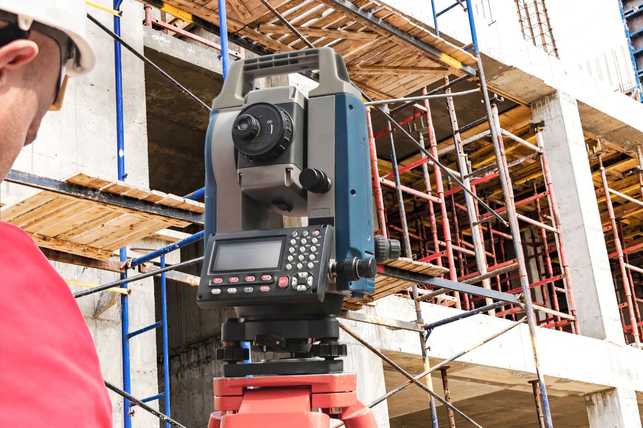
Site engineering and setting out surveys transfer the design intent from engineering drawings or digital models onto the physical site.
Before setting out begins, a site control network is established or verified to ensure that all construction measurements are referenced to a consistent coordinate framework.
Setting out coordinates are derived from approved design drawings or digital models and prepared for use with survey instrumentation. These coordinates are then transferred to the site using total station or GNSS equipment to position construction elements accurately.
Where required, as-built surveys are undertaken to verify that installed elements meet the required positional tolerances.
Setting out and verification activities typically produce the following deliverables:
Survey control network verification reports.
Dimensional compliance reports.
As-built verification surveys.
Coordinate schedules for construction elements.
Digital field data for survey instruments.
Coordinate datasets of installed works.
These datasets provide objective confirmation that construction works have been positioned in accordance with the design geometry.
Profind Surveys starts with a consultation so we understand your requirements and recommend the right approach for your programme and deliverables.


Scope and tolerances defined before mobilisation, aligned to programme stages.
Verified control, documented datum and grid consistency.
Quality-assured setting out and compliance records aligned to ITPs.
As-built verification and technical clarification where required.
If you require site engineering and setting out delivered under defined methodology and structured QA, contact Profind Surveys Ltd to discuss your programme, tolerances and site constraints.
No. We can work from existing survey outputs and drawings. It’s just quicker and cleaner when Profind captures the data as well.
Yes. We can support conversions like PDF to DWG where needed.
Yes. We can convert GPR data into detailed 2D models and drawings.
We’ll confirm formats during scoping (DWG, PDF, and others depending on the project).
Profind Surveys is based in Tamworth and focuses on the Midlands.